Geolocate

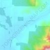
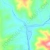
Phoenix topographic map

Click on the map to display elevation.

About this map
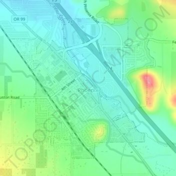
Name: Phoenix topographic map, elevation, terrain.

Location: Phoenix, Jackson County, Oregon, 97535, United States (42.26358 -122.83158 42.28502 -122.80179)

Average elevation: 1,539 ft

Minimum elevation: 1,450 ft

Maximum elevation: 1,775 ft

Jackson County trails, hiking, mountain biking, running and outdoor activities

Other topographic maps

Click on a map to view its topography, its elevation and its terrain.
Ruch

United States > Oregon > Jackson County

Average elevation: 1,837 ft

Wimer

United States > Oregon > Jackson County

Average elevation: 1,368 ft

Applegate

United States > Oregon > Jackson County

Average elevation: 1,644 ft

Mount McLoughlin

United States > Oregon > Jackson County

The major landmark for the Rogue River Valley, Mount McLoughlin reaches an elevation of 9,493 ft (2,893 m). The tallest volcano in between Mount Shasta — located 70 mi (110 km) to the south — and South Sister 120 miles (190 km) to the north, it lies in the Cascade Range, in the southern portion of the U.S.…

Average elevation: 7,533 ft

Woodrat Mountain

United States > Oregon > Jackson County

Average elevation: 3,058 ft

Mount Ashland

United States > Oregon > Jackson County

Average elevation: 6,421 ft

Trail

United States > Oregon > Jackson County

Average elevation: 1,752 ft

Siskiyou Mountains

United States > Oregon > Jackson County

Average elevation: 4,656 ft

Panorama Point

United States > Oregon > Jackson County > Jacksonville

Average elevation: 1,877 ft

Buncom

United States > Oregon > Jackson County

Average elevation: 2,146 ft

Barneburg Hill

United States > Oregon > Jackson County > Medford

Average elevation: 1,453 ft

Ruch

United States > Oregon > Jackson County

Average elevation: 1,837 ft

Gear up for your next adventure:

🦶Hiking Gaiters - Keep debris and water out of your boots
🌧️Backpack Rain Cover - Keep gear dry in wet weather
📌Outdoor GPS Map App - Apps and devices for digital topographic navigation
📷Action Cameras - Rugged cameras to document your journeys across rugged terrain
🏔️Mountain Trail Maps - High‑detail maps for popular peaks

As an Amazon Associate, this site earns from qualifying purchases at no extra cost to you.