Geolocate

Kraton topographic map

Click on the map to display elevation.

About this map

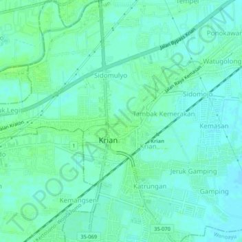
Name: Kraton topographic map, elevation, terrain.

Location: Kraton, Krian, Sidoarjo, East Java, Java, 61262, Indonesia (-7.42752 112.56063 -7.38752 112.60063)

Average elevation: 43 ft

Minimum elevation: 30 ft

Maximum elevation: 62 ft

Other topographic maps

Click on a map to view its topography, its elevation and its terrain.

Prambon

Indonesia > East Java > Sidoarjo

Average elevation: 43 ft

Krembung

Indonesia > East Java > Sidoarjo

Average elevation: 33 ft

Tanggulangin

Indonesia > East Java > Sidoarjo

Average elevation: 10 ft

Tulangan

Indonesia > East Java > Sidoarjo

Average elevation: 26 ft

Gear up for your next adventure:

👟Trail Running Shoes - Lightweight shoes for trail runners
🧭Outdoor Navigation Book - Learn advanced navigation skills
🧭Hiking Compass - Precision compass for reliable navigation in the wilderness
🦺Reflective Outdoor Gear - Safety gear for low‑light conditions
🪵Folding Camp Saw - Compact saw for wood and campsite work

As an Amazon Associate, this site earns from qualifying purchases at no extra cost to you.