Geolocate

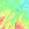
Dover topographic map

Click on the map to display elevation.

About this map

Name: Dover topographic map, elevation, terrain.

Location: Dover, Kent, England, CT16 1NB, United Kingdom (51.08513 1.27342 51.16513 1.35342)

Average elevation: 167 ft

Minimum elevation: 0 ft

Maximum elevation: 466 ft

Other topographic maps

Click on a map to view its topography, its elevation and its terrain.
Sandwich

United Kingdom > England > Kent > Dover > Stone Cross

Average elevation: 16 ft

Eastry

United Kingdom > England > Kent > Dover > Eastry

Average elevation: 105 ft

Whitfield

United Kingdom > England > Kent > Dover

Average elevation: 331 ft

Temple Ewell

United Kingdom > England > Kent > Dover

Average elevation: 315 ft

Alkham

United Kingdom > England > Kent > Dover

Average elevation: 390 ft

Nonington

United Kingdom > England > Kent > Dover

Average elevation: 223 ft

Tilmanstone

United Kingdom > England > Kent > Dover

Average elevation: 226 ft

Wingham

United Kingdom > England > Kent > Dover

Average elevation: 72 ft

Whitfield

United Kingdom > England > Kent > Dover > Whitfield

Average elevation: 331 ft

River

United Kingdom > England > Kent > Dover

Average elevation: 262 ft

Sandwich

United Kingdom > England > Kent > Dover

Average elevation: 16 ft

Deal

United Kingdom > England > Kent > Dover

Average elevation: 20 ft

River

United Kingdom > England > Kent > Dover > River

Average elevation: 262 ft

Gear up for your next adventure:

👖Convertible Hiking Pants - Versatile zip-off pants for changing altitudes and temperatures
🔌Solar Panel Charger - Charge gear sustainably outdoors
🥾Hiking Shoes - Durable and comfortable shoes for trail hiking
🎒Trekking Poles - Sturdy poles for balance and stability on rough terrain
🎒Day Hiking Backpack - Lightweight backpack perfect for day trips and outdoor adventures

As an Amazon Associate, this site earns from qualifying purchases at no extra cost to you.