Geolocate

Caluangan topographic map

Click on the map to display elevation.

About this map

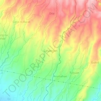
Name: Caluangan topographic map, elevation, terrain.

Location: Caluangan, Calaca, Batangas, Calabarzon, 4209, Philippines (13.92339 120.83564 13.96339 120.87564)

Average elevation: 397 ft

Minimum elevation: 72 ft

Maximum elevation: 728 ft

Other topographic maps

Click on a map to view its topography, its elevation and its terrain.

Dacanlao River

Philippines > Batangas > Calaca

Average elevation: 259 ft

Gear up for your next adventure:

🪶Trail Camera - Capture wildlife on your hikes
🧭Outdoor Navigation Book - Learn advanced navigation skills
📷Action Camera - Capture your outdoor adventures in HD
🌲Outdoor Survival Books - Best books on survival skills
🦶Carbon Trekking Poles - Reduce knee impact on steep descents with ultra-light poles

As an Amazon Associate, this site earns from qualifying purchases at no extra cost to you.