
Clawson topographic map
Click on the map to display elevation.
About this map
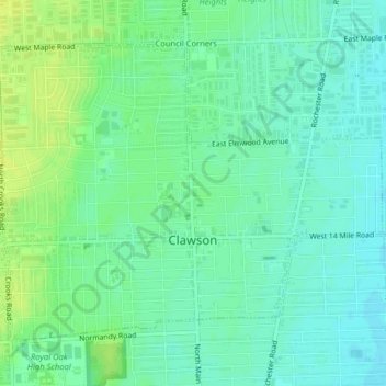
Name: Clawson topographic map, elevation, terrain.
Location: Clawson, Oakland County, Michigan, 48017, United States (42.52557 -83.16656 42.54830 -83.12673)
Average elevation: 676 ft
Minimum elevation: 650 ft
Maximum elevation: 705 ft
Oakland County trails, hiking, mountain biking, running and outdoor activities
Other topographic maps
Click on a map to view its topography, its elevation and its terrain.
Waterbury Lake
United States > Michigan > Oakland County > Highland Charter Township
Average elevation: 1,010 ft
Veterans Park
United States > Michigan > Oakland County > Highland Charter Township
Average elevation: 1,017 ft
Davisburg
United States > Michigan > Oakland County > Springfield Charter Township
Average elevation: 1,014 ft
Round Lake
United States > Michigan > Oakland County > Orion Charter Township
Average elevation: 994 ft
Hickory Ridge
United States > Michigan > Oakland County > Highland Charter Township
Average elevation: 1,070 ft
Seven Harbors
United States > Michigan > Oakland County > Highland Charter Township
Average elevation: 1,030 ft
Carpenter Lake Nature Preserve
United States > Michigan > Oakland County > Southfield
Average elevation: 679 ft
Wood Creek Farms
United States > Michigan > Oakland County > Farmington Hills > Wood Creek Farms
Average elevation: 804 ft
Depot Park
United States > Michigan > Oakland County > Village of Clarkston
Average elevation: 1,010 ft