
Olmos topographic map
Click on the map to display elevation.
About this map
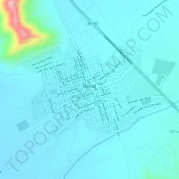
Name: Olmos topographic map, elevation, terrain.
Location: Olmos, Lambayeque, Perú (-5.99515 -79.75537 -5.98222 -79.73588)
Average elevation: 607 ft
Minimum elevation: 522 ft
Maximum elevation: 1,211 ft
Other topographic maps
Click on a map to view its topography, its elevation and its terrain.
Área de Conservación Regional Bosque Huacrupe-La Calera
Perú > Lambayeque > Olmos
Average elevation: 489 ft