Geolocate

Paudpod topographic map

Click on the map to display elevation.

About this map

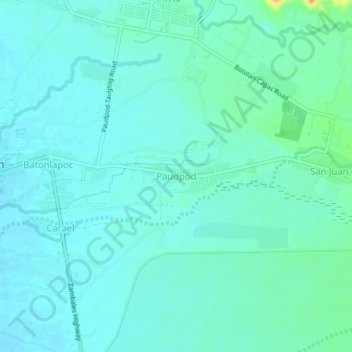
Name: Paudpod topographic map, elevation, terrain.

Location: Paudpod, Zambales, Central Luzon, 2202, Philippines (15.26768 120.02738 15.30768 120.06738)

Average elevation: 59 ft

Minimum elevation: 30 ft

Maximum elevation: 187 ft

Other topographic maps

Click on a map to view its topography, its elevation and its terrain.

Hermana Mayor Island

Philippines > Zambales

Average elevation: 13 ft

Capones

Philippines > Zambales

Average elevation: 3 ft

Hermana Menor Island

Philippines > Zambales

Average elevation: 3 ft

Subic

Philippines > Zambales

Average elevation: 558 ft

Anawangin Cove

Philippines > Zambales

Average elevation: 197 ft

Nagsasa Cove

Philippines > Zambales

Average elevation: 125 ft

Camara

Philippines > Zambales

Average elevation: 0 ft

Redondo Peninsula

Philippines > Zambales

Average elevation: 394 ft

Mangan-vaca River

Philippines > Zambales > Subic > Ilwas

Average elevation: 108 ft

Santo Tomas River

Philippines > Zambales > Rabanes

Average elevation: 427 ft

Acid Lake

Philippines > Zambales > Subic

Average elevation: 1,280 ft

Mapanuepe Lake

Philippines > Zambales > Aglao

Average elevation: 640 ft

Subic

Philippines > Zambales

Average elevation: 558 ft

Subic

Philippines > Zambales

Average elevation: 558 ft

Nagsasa Cove

Philippines > Zambales

Average elevation: 125 ft

Santo Tomas River

Philippines > Zambales > Rabanes

Average elevation: 427 ft

Gear up for your next adventure:

🦶Carbon Trekking Poles - Reduce knee impact on steep descents with ultra-light poles
🕶️GPS Smartphone Mount - Secure mount for phone navigation
🔋Solar Power Banks - Keep your GPS and phone charged in remote wilderness areas
🥘Titanium Cookware - Durable, featherlight pots and pans for backpacking
🖼️Topo Map Wall Art - Decorative topographic prints of famous peaks and regions

As an Amazon Associate, this site earns from qualifying purchases at no extra cost to you.