
Thank you for supporting this site ❤️
Make a donation
Make a donation
Gear up for your next adventure:
As an Amazon Associate, this site earns from qualifying purchases at no extra cost to you.
Chanchalito topographic map
Click on the map to display elevation.
Thank you for supporting this site ❤️
Make a donation
Make a donation
Gear up for your next adventure:
As an Amazon Associate, this site earns from qualifying purchases at no extra cost to you.
About this map
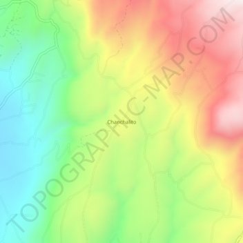
Name: Chanchalito topographic map, elevation, terrain.
Location: Chanchalito, Mulliquindil, Salcedo, Cotopaxi, Ecuador (-1.03944 -78.55612 -0.99944 -78.51612)
Average elevation: 10,085 ft
Minimum elevation: 8,934 ft
Maximum elevation: 11,470 ft
Thank you for supporting this site ❤️
Make a donation
Make a donation
Gear up for your next adventure:
As an Amazon Associate, this site earns from qualifying purchases at no extra cost to you.