Geolocate

Town of Omro topographic map

Interactive map

Click on the map to display elevation.

About this map

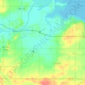
Name: Town of Omro topographic map, elevation, terrain.

Location: Town of Omro, Winnebago County, Wisconsin, United States (43.98224 -88.78509 44.06948 -88.64300)

Average elevation: 791 ft

Minimum elevation: 741 ft

Maximum elevation: 896 ft

Routes: Winnebago County GPS tracks, routes, trails, hikes

Other topographic maps

Click on a map to view its topography, its elevation and its terrain.

Oshkosh

United States > Wisconsin > Winnebago County

Average elevation: 771 ft

Fox Crossing

United States > Wisconsin > Winnebago County

Average elevation: 781 ft

Winneconne

United States > Wisconsin > Winnebago County

Average elevation: 755 ft

Larsen

United States > Wisconsin > Winnebago County

Average elevation: 781 ft

Oshkosh

United States > Wisconsin > Winnebago County > Oshkosh

Average elevation: 784 ft

Lake Poygan

United States > Wisconsin > Winnebago County

Average elevation: 755 ft