
Thank you for supporting this site ❤️
Make a donation
Make a donation
Gear up for your next adventure:
As an Amazon Associate, this site earns from qualifying purchases at no extra cost to you.
Villaretto topographic map
Click on the map to display elevation.
Thank you for supporting this site ❤️
Make a donation
Make a donation
Gear up for your next adventure:
As an Amazon Associate, this site earns from qualifying purchases at no extra cost to you.
About this map
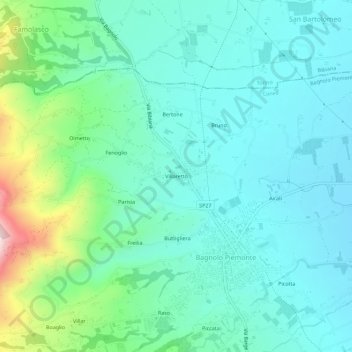
Name: Villaretto topographic map, elevation, terrain.
Location: Villaretto, Bagnolo Piemonte, Cuneo, Piemonte, 12031, Italia (44.74953 7.28600 44.78953 7.32600)
Average elevation: 1,339 ft
Minimum elevation: 1,066 ft
Maximum elevation: 2,333 ft
Thank you for supporting this site ❤️
Make a donation
Make a donation
Gear up for your next adventure:
As an Amazon Associate, this site earns from qualifying purchases at no extra cost to you.