Geolocate

Escheck topographic map

Click on the map to display elevation.

About this map

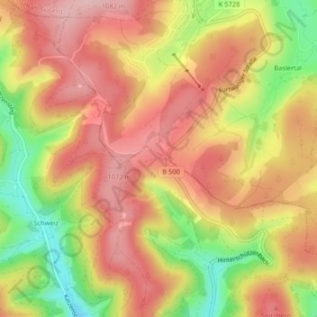
Name: Escheck topographic map, elevation, terrain.

Location: Escheck, Furtwangen im Schwarzwald, VVG der Stadt Furtwangen im Schwarzwald, Schwarzwald-Baar-Kreis, Baden-Württemberg, 78120, Germany (48.07841 8.18663 48.09841 8.20663)

Average elevation: 3,317 ft

Minimum elevation: 2,943 ft

Maximum elevation: 3,563 ft

Gear up for your next adventure:

🌎3D Topographic Globes - Raised relief globes for a tactile understanding of geography
🦶Carbon Trekking Poles - Reduce knee impact on steep descents with ultra-light poles
📦Dry Bags Set - Waterproof storage for electronics and clothes
🔋Solar Power Banks - Keep your GPS and phone charged in remote wilderness areas
📱Solar Portable Charger - Solar power bank for charging devices off‑grid

As an Amazon Associate, this site earns from qualifying purchases at no extra cost to you.