
Thank you for supporting this site ❤️
Make a donation
Make a donation
Gear up for your next adventure:
As an Amazon Associate, this site earns from qualifying purchases at no extra cost to you.
Kerling topographic map
Click on the map to display elevation.
Thank you for supporting this site ❤️
Make a donation
Make a donation
Gear up for your next adventure:
As an Amazon Associate, this site earns from qualifying purchases at no extra cost to you.
About this map
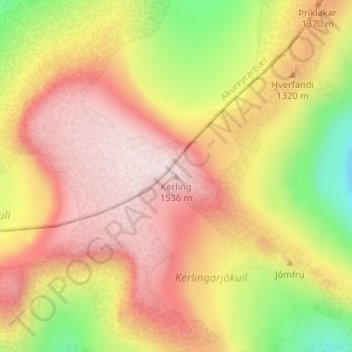
Name: Kerling topographic map, elevation, terrain.
Location: Kerling, Eyjafjarðarsveit, Northeastern Region, Iceland (65.55732 -18.25400 65.55742 -18.25390)
Average elevation: 4,134 ft
Minimum elevation: 2,979 ft
Maximum elevation: 5,016 ft
Thank you for supporting this site ❤️
Make a donation
Make a donation
Gear up for your next adventure:
As an Amazon Associate, this site earns from qualifying purchases at no extra cost to you.