
Thank you for supporting this site ❤️
Make a donation
Make a donation
Gear up for your next adventure:
As an Amazon Associate, this site earns from qualifying purchases at no extra cost to you.
Mondorf topographic map
Click on the map to display elevation.
Thank you for supporting this site ❤️
Make a donation
Make a donation
Gear up for your next adventure:
As an Amazon Associate, this site earns from qualifying purchases at no extra cost to you.
About this map
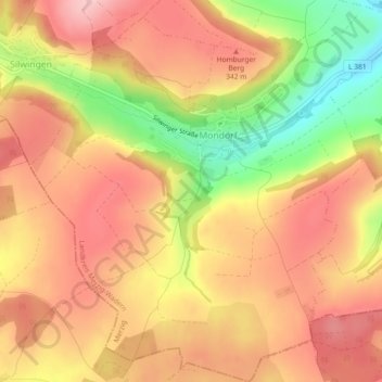
Name: Mondorf topographic map, elevation, terrain.
Location: Mondorf, Merzig, Landkreis Merzig-Wadern, Saarland, Germany (49.39744 6.57429 49.42705 6.61837)
Average elevation: 994 ft
Minimum elevation: 633 ft
Maximum elevation: 1,217 ft
Thank you for supporting this site ❤️
Make a donation
Make a donation
Gear up for your next adventure:
As an Amazon Associate, this site earns from qualifying purchases at no extra cost to you.