
Thank you for supporting this site ❤️
Make a donation
Make a donation
Gear up for your next adventure:
As an Amazon Associate, this site earns from qualifying purchases at no extra cost to you.
Włocławek topographic map
Click on the map to display elevation.
Thank you for supporting this site ❤️
Make a donation
Make a donation
Gear up for your next adventure:
As an Amazon Associate, this site earns from qualifying purchases at no extra cost to you.
About this map
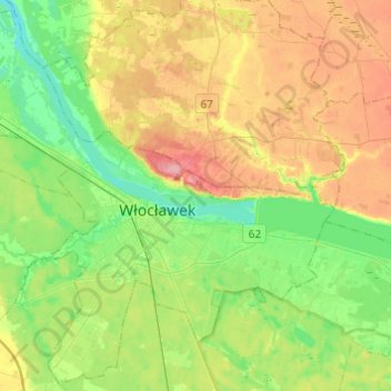
Name: Włocławek topographic map, elevation, terrain.
Location: Włocławek, Kuyavian-Pomeranian Voivodeship, Poland (52.59479 18.93905 52.73597 19.18261)
Average elevation: 240 ft
Minimum elevation: 105 ft
Maximum elevation: 440 ft
Thank you for supporting this site ❤️
Make a donation
Make a donation
Gear up for your next adventure:
As an Amazon Associate, this site earns from qualifying purchases at no extra cost to you.