
Thank you for supporting this site ❤️
Make a donation
Make a donation
Gear up for your next adventure:
As an Amazon Associate, this site earns from qualifying purchases at no extra cost to you.
Chaparaco topographic map
Click on the map to display elevation.
Thank you for supporting this site ❤️
Make a donation
Make a donation
Gear up for your next adventure:
As an Amazon Associate, this site earns from qualifying purchases at no extra cost to you.
About this map
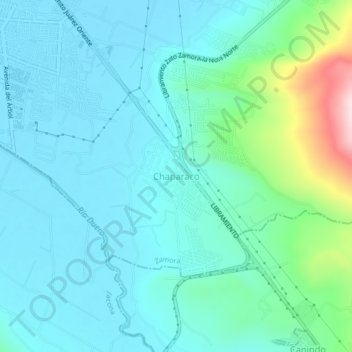
Name: Chaparaco topographic map, elevation, terrain.
Location: Chaparaco, Zamora, Michoacán, 59669, Mexico (19.94012 -102.27985 19.98012 -102.23985)
Average elevation: 5,328 ft
Minimum elevation: 5,138 ft
Maximum elevation: 6,214 ft
Thank you for supporting this site ❤️
Make a donation
Make a donation
Gear up for your next adventure:
As an Amazon Associate, this site earns from qualifying purchases at no extra cost to you.