
Make a donation
Gear up for your next adventure:
As an Amazon Associate, this site earns from qualifying purchases at no extra cost to you.
Escarigo topographic map
Click on the map to display elevation.
Make a donation
Gear up for your next adventure:
As an Amazon Associate, this site earns from qualifying purchases at no extra cost to you.
About this map
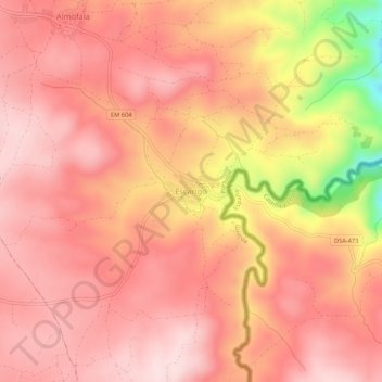
Name: Escarigo topographic map, elevation, terrain.
Location: Escarigo, Figueira de Castelo Rodrigo, Guarda, Portugal (40.82293 -6.85125 40.86293 -6.81125)
Average elevation: 2,044 ft
Minimum elevation: 1,260 ft
Maximum elevation: 2,333 ft
Make a donation
Gear up for your next adventure:
As an Amazon Associate, this site earns from qualifying purchases at no extra cost to you.
Other topographic maps
Click on a map to view its topography, its elevation and its terrain.
Linha de cumeada da serra da Marofa
Portugal > Guarda > Figueira de Castelo Rodrigo
Average elevation: 2,001 ft
Castelo Rodrigo
Portugal > Guarda > Figueira de Castelo Rodrigo
Ocupado sucessivamente pelos túrdulos, romanos e mouros, o actual concelho de Figueira de Castelo Rodrigo foi integrado no Reino de Leão no século XI, integrando definitivamente o território português em 1297. Até ao século XIX chamava-se apenas Castelo Rodrigo, em homenagem ao alcaide D. Rodrigo, que…
Average elevation: 2,126 ft
Make a donation
Gear up for your next adventure:
As an Amazon Associate, this site earns from qualifying purchases at no extra cost to you.
Algodres, Vale de Afonsinho e Vilar de Amargo
Portugal > Guarda > Figueira de Castelo Rodrigo
Average elevation: 1,690 ft