
Thank you for supporting this site ❤️
Make a donation
Make a donation
Gear up for your next adventure:
As an Amazon Associate, this site earns from qualifying purchases at no extra cost to you.
Huaracalla topographic map
Click on the map to display elevation.
Thank you for supporting this site ❤️
Make a donation
Make a donation
Gear up for your next adventure:
As an Amazon Associate, this site earns from qualifying purchases at no extra cost to you.
About this map
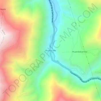
Name: Huaracalla topographic map, elevation, terrain.
Location: Huaracalla, Ambo, Huánuco, Perú (-10.19140 -76.21015 -10.15140 -76.17015)
Average elevation: 8,428 ft
Minimum elevation: 6,975 ft
Maximum elevation: 10,561 ft
Thank you for supporting this site ❤️
Make a donation
Make a donation
Gear up for your next adventure:
As an Amazon Associate, this site earns from qualifying purchases at no extra cost to you.