Geolocate

Nolin topographic map

Click on the map to display elevation.

About this map

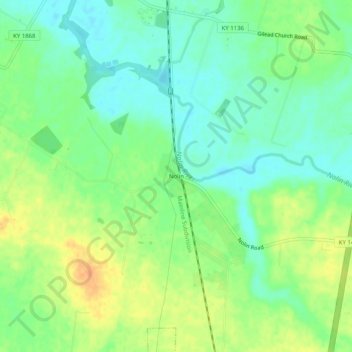
Name: Nolin topographic map, elevation, terrain.

Location: Nolin, Hardin County, Kentucky, 42740, United States (37.54117 -85.92274 37.58117 -85.88274)

Average elevation: 689 ft

Minimum elevation: 640 ft

Maximum elevation: 758 ft

Hardin County trails, hiking, mountain biking, running and outdoor activities

Other topographic maps

Click on a map to view its topography, its elevation and its terrain.

Upton

United States > Kentucky > Hardin County

Average elevation: 755 ft

Sonora

United States > Kentucky > Hardin County

Average elevation: 725 ft

West Point

United States > Kentucky > Hardin County

Average elevation: 535 ft

Vine Grove

United States > Kentucky > Hardin County

Average elevation: 715 ft

Gear up for your next adventure:

🎒Day Hiking Backpack - Lightweight backpack perfect for day trips and outdoor adventures
🥇GPS Hiking Watch - Multi‑sport GPS watch with navigation and trail tracking
🧥Waterproof Jacket for Hiking - Breathable and rugged rain jacket for outdoor excursions
🚗GPS Dash Cams - Record your scenic drives through mountain passes and canyons
🚪Portable Camp Chair - Foldable chair for comfort at camp

As an Amazon Associate, this site earns from qualifying purchases at no extra cost to you.