Geolocate

Hollis topographic map

Click on the map to display elevation.

About this map

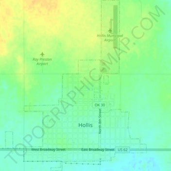
Name: Hollis topographic map, elevation, terrain.

Location: Hollis, Harmon County, Oklahoma, 73550, United States (34.67644 -99.93427 34.71064 -99.90158)

Average elevation: 1,644 ft

Minimum elevation: 1,604 ft

Maximum elevation: 1,690 ft

Harmon County trails, hiking, mountain biking, running and outdoor activities

Other topographic maps

Click on a map to view its topography, its elevation and its terrain.

Vinson

United States > Oklahoma > Harmon County

Average elevation: 1,877 ft

Vinson

United States > Oklahoma > Harmon County

Average elevation: 1,877 ft

Gear up for your next adventure:

🛶Inflatable Kayak - Portable kayak for rivers, lakes, and expeditions
🪶Survival Guide Book - Expert advice for emergency preparedness
🛰️Handheld GPS Units - Professional satellite navigators for precise backcountry mapping
🏕️Family Camping Gear - Essentials for group camping trips
🩹Survival Bandages - High‑quality bandages for emergencies

As an Amazon Associate, this site earns from qualifying purchases at no extra cost to you.