Geolocate

Gilasca topographic map

Click on the map to display elevation.

About this map

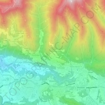
Name: Gilasca topographic map, elevation, terrain.

Location: Gilasca, Solzago, Tavernerio, Como, Lombardia, 22038, Italia (45.78778 9.11432 45.82778 9.15432)

Average elevation: 1,847 ft

Minimum elevation: 807 ft

Maximum elevation: 3,504 ft

Gear up for your next adventure:

🦶Hiking Gaiters - Keep debris and water out of your boots
Camping Coffee Makers - Enjoy premium coffee at the summit or campsite
🛡️Bear Spray Outdoor - Protection in bear country hikes
💧Water Purification System - Clean water on the trail with reliable purifiers
🥇GPS Hiking Watch - Multi‑sport GPS watch with navigation and trail tracking

As an Amazon Associate, this site earns from qualifying purchases at no extra cost to you.