
Albin topographic map
Click on the map to display elevation.
About this map
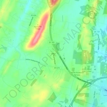
Name: Albin topographic map, elevation, terrain.
Location: Albin, Frederick County, Virginia, 22603, United States (39.20177 -78.21861 39.24177 -78.17861)
Average elevation: 886 ft
Minimum elevation: 774 ft
Maximum elevation: 1,102 ft
Frederick County trails, hiking, mountain biking, running and outdoor activities
Other topographic maps
Click on a map to view its topography, its elevation and its terrain.
Kernstown Battlefield Park
United States > Virginia > Frederick County > Winchester > Valley Acres
Average elevation: 791 ft