Geolocate

Bukere B topographic map

Click on the map to display elevation.

About this map

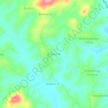
Name: Bukere B topographic map, elevation, terrain.

Location: Bukere B, Kyegegwa, Western Region, Uganda (0.37027 31.07638 0.41027 31.11638)

Average elevation: 4,259 ft

Minimum elevation: 4,114 ft

Maximum elevation: 4,642 ft

Gear up for your next adventure:

⛑️Personal Locator Beacon - Safety beacon for emergencies
🪶Fire Starter Kit - Reliable fire starter for survival and camping
🔥Camping Stove - Portable stove for camping and backcountry cooking
🧦Hiking Socks - Comfortable socks to prevent blisters on long hikes
🎒Gear Packing Cubes - Organize your backpack efficiently

As an Amazon Associate, this site earns from qualifying purchases at no extra cost to you.