Geolocate

Anyara topographic map

Click on the map to display elevation.

About this map

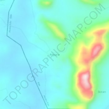
Name: Anyara topographic map, elevation, terrain.

Location: Anyara, Akoko-Edo, Edo State, Nigeria (7.46040 5.94580 7.50040 5.98580)

Average elevation: 1,181 ft

Minimum elevation: 912 ft

Maximum elevation: 2,316 ft

Gear up for your next adventure:

Backpacking Tent - Lightweight and durable tent for multi‑day hikes
🗺️NatGeo Topo Maps - High-quality waterproof printed topographic maps of US Parks
🪶Camping Sleeping Pad - Comfortable sleeping pad for backpacking
🪶Paracord Bracelet - Survival bracelet with built‑in tools
🦶Carbon Trekking Poles - Reduce knee impact on steep descents with ultra-light poles

As an Amazon Associate, this site earns from qualifying purchases at no extra cost to you.