Geolocate

Dharmkot topographic map

Click on the map to display elevation.

About this map

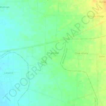
Name: Dharmkot topographic map, elevation, terrain.

Location: Dharmkot, Dasua Tahsil, Hoshiarpur, Punjab, 144210, India (31.65806 75.72410 31.69806 75.76410)

Average elevation: 892 ft

Minimum elevation: 856 ft

Maximum elevation: 942 ft

Other topographic maps

Click on a map to view its topography, its elevation and its terrain.

Dasua Tahsil

India > Punjab > Dasua Tahsil

Average elevation: 1,014 ft

Gear up for your next adventure:

📡Handheld GPS Device - Reliable handheld GPS for outdoor navigation
🌐World Map Poster - Decorative world maps with topographic info
🔋Solar Power Banks - Keep your GPS and phone charged in remote wilderness areas
💧Water Purification System - Clean water on the trail with reliable purifiers
🪑Portable Camp Table - Compact table for campsite meals

As an Amazon Associate, this site earns from qualifying purchases at no extra cost to you.