
白鹿镇 topographic map
Interactive map
Click on the map to display elevation.
About this map
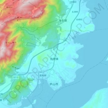
Name: 白鹿镇 topographic map, elevation, terrain.
Location: 白鹿镇, 庐山市, 九江市, 江西省, 中国 (29.44633 115.95984 29.53967 116.13731)
Average elevation: 748 ft
Minimum elevation: 23 ft
Maximum elevation: 4,760 ft
Other topographic maps
Click on a map to view its topography, its elevation and its terrain.