
Thank you for supporting this site ❤️
Make a donation
Make a donation
Gear up for your next adventure:
As an Amazon Associate, this site earns from qualifying purchases at no extra cost to you.
Pike Peak topographic map
Click on the map to display elevation.
Thank you for supporting this site ❤️
Make a donation
Make a donation
Gear up for your next adventure:
As an Amazon Associate, this site earns from qualifying purchases at no extra cost to you.
About this map
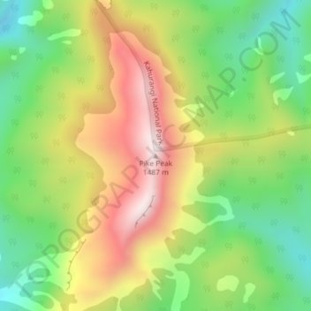
Name: Pike Peak topographic map, elevation, terrain.
Location: Pike Peak, Buller District, West Coast, New Zealand (-41.44214 172.35770 -41.44204 172.35780)
Average elevation: 3,622 ft
Minimum elevation: 2,625 ft
Maximum elevation: 4,843 ft
Thank you for supporting this site ❤️
Make a donation
Make a donation
Gear up for your next adventure:
As an Amazon Associate, this site earns from qualifying purchases at no extra cost to you.