Geolocate

Brechin topographic map

Click on the map to display elevation.

About this map

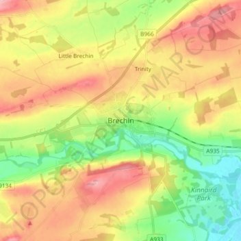
Name: Brechin topographic map, elevation, terrain.

Location: Brechin, Angus, Scotland, DD9 6ET, United Kingdom (56.69159 -2.69990 56.77159 -2.61990)

Average elevation: 233 ft

Minimum elevation: 20 ft

Maximum elevation: 463 ft

Gear up for your next adventure:

🩹Survival Bandages - High‑quality bandages for emergencies
🗺️Topographic Maps - Detailed topo maps for hiking, exploring and outdoor navigation
🥄Camping Utensil Set - Lightweight utensils for outdoor meals
🔭Stargazing Telescopes - Perfect for camping in low-light pollution areas shown on maps
🖼️Topo Map Wall Art - Decorative topographic prints of famous peaks and regions

As an Amazon Associate, this site earns from qualifying purchases at no extra cost to you.