
Thank you for supporting this site ❤️
Make a donation
Make a donation
Gear up for your next adventure:
As an Amazon Associate, this site earns from qualifying purchases at no extra cost to you.
Brechin topographic map
Click on the map to display elevation.
Thank you for supporting this site ❤️
Make a donation
Make a donation
Gear up for your next adventure:
As an Amazon Associate, this site earns from qualifying purchases at no extra cost to you.
About this map
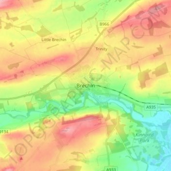
Name: Brechin topographic map, elevation, terrain.
Location: Brechin, Angus, Scotland, DD9 6ET, United Kingdom (56.69159 -2.69990 56.77159 -2.61990)
Average elevation: 233 ft
Minimum elevation: 20 ft
Maximum elevation: 463 ft
Thank you for supporting this site ❤️
Make a donation
Make a donation
Gear up for your next adventure:
As an Amazon Associate, this site earns from qualifying purchases at no extra cost to you.