

Trimbak topographic map
Click on the map to display elevation.
Trimbak
Trimbak is located at 19°34′N 73°19′E / 19.56°N 73.32°E / 19.56; 73.32, and maintains an average elevation of around 720 meters (2,362 feet) above mean sea level. The town is nestled within the hilly terrain of the Trimbakeshwar Range, which forms a section of the Western Ghats.On the western side of the town lies the Brahmagiri Hill, the highest point in the immediate vicinity, reaching an elevation of 1,295 meters (4,248 feet). The range's geology is primarily composed of flood basalt and is part of the Deccan Traps region. Trimbak is accessible by road, located approximately 28-30 km from Nashik city and about 180 km from Mumbai.
About this map
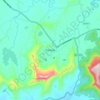
Name: Trimbak topographic map, elevation, terrain.
Average elevation: 2,480 ft
Minimum elevation: 2,067 ft
Maximum elevation: 4,262 ft