
Thank you for supporting this site ❤️
Make a donation
Make a donation
Gear up for your next adventure:
As an Amazon Associate, this site earns from qualifying purchases at no extra cost to you.
Obern topographic map
Click on the map to display elevation.
Thank you for supporting this site ❤️
Make a donation
Make a donation
Gear up for your next adventure:
As an Amazon Associate, this site earns from qualifying purchases at no extra cost to you.
About this map
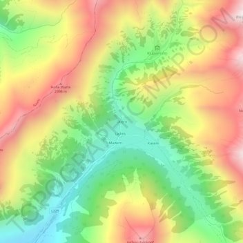
Name: Obern topographic map, elevation, terrain.
Location: Obern, Schmirn, Bezirk Innsbruck-Land, Tyrol, Autriche (47.08940 11.58338 47.12940 11.62338)
Average elevation: 6,519 ft
Minimum elevation: 4,829 ft
Maximum elevation: 8,432 ft
Thank you for supporting this site ❤️
Make a donation
Make a donation
Gear up for your next adventure:
As an Amazon Associate, this site earns from qualifying purchases at no extra cost to you.