
Make a donation
Gear up for your next adventure:
As an Amazon Associate, this site earns from qualifying purchases at no extra cost to you.
Spalbeek topographic map
Click on the map to display elevation.
Make a donation
Gear up for your next adventure:
As an Amazon Associate, this site earns from qualifying purchases at no extra cost to you.
About this map
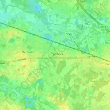
Name: Spalbeek topographic map, elevation, terrain.
Location: Spalbeek, Hasselt, Limburg, Vlaanderen, België (50.92442 5.21213 50.96694 5.23878)
Average elevation: 89 ft
Minimum elevation: 59 ft
Maximum elevation: 118 ft
Make a donation
Gear up for your next adventure:
As an Amazon Associate, this site earns from qualifying purchases at no extra cost to you.
Other topographic maps
Click on a map to view its topography, its elevation and its terrain.
Kortessem
België > Limburg > Hasselt > Hasselt
Het dorp ontstond als een driehoekige nederzetting, geflankeerd door de Heerbaan van Hasselt naar Tongeren (tegenwoordig: Mersenhovenstraat), de Klokkenhofsteeg en de (huidige) Dorpsstraat. Van belang is de weg van Hasselt naar Tongeren, welke omstreeks 1740 werd aangelegd (zie: Steenweg op Luik). De…
Average elevation: 174 ft