Geolocate

Bambey topographic map

Click on the map to display elevation.

About this map

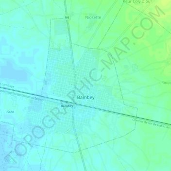
Name: Bambey topographic map, elevation, terrain.

Location: Bambey, Département de Bambey, Diourbel Region, Senegal (14.68028 -16.48285 14.71694 -16.43472)

Average elevation: 72 ft

Minimum elevation: 56 ft

Maximum elevation: 98 ft

Other topographic maps

Click on a map to view its topography, its elevation and its terrain.

Dakar

Senegal > Dakar

Average elevation: 36 ft

Island of Gorée

Senegal > Dakar Region > Dakar

Recently, Hamady Bocoum et Bernard Toulier published an article "The Fabrication of Heritage: the case of Gorée (Senegal)" (in French: "La fabrication du Patrimoine: l’exemple de Gorée (Sénégal)") documenting the elevation of Gorée to an emotionally charged memorial of the transatlantic slave trade for…

Average elevation: 0 ft

Cad

Senegal > Communauté rurale de Mabo

Average elevation: 138 ft

Guéréo

Senegal > Communauté rurale de Sindia

Average elevation: 62 ft

Bougnadou

Senegal > Communauté rurale de Sakar

Average elevation: 16 ft

Diana

Senegal > Communauté rurale de Paroumba

Average elevation: 223 ft

Djilakh

Senegal > Communauté rurale de Sindia

Average elevation: 56 ft

Mambi

Senegal > Communauté rurale de Porokhane

Average elevation: 102 ft

Petikan

Senegal > Communauté rurale de Niaguis

Average elevation: 59 ft

Guète

Senegal > Communauté rurale de Thiakhar

Average elevation: 105 ft

Seleti

Senegal > Communauté rurale de Kataba 1

Average elevation: 59 ft

Djilakh

Senegal > Communauté rurale de Sindia

Average elevation: 56 ft

Island of Gorée

Senegal > Dakar Region > Dakar

Recently, Hamady Bocoum et Bernard Toulier published an article "The Fabrication of Heritage: the case of Gorée (Senegal)" (in French: "La fabrication du Patrimoine: l’exemple de Gorée (Sénégal)") documenting the elevation of Gorée to an emotionally charged memorial of the transatlantic slave trade for…

Average elevation: 0 ft

Bousra

Senegal > Communauté rurale de Sadio

Average elevation: 161 ft

Diourbel

Senegal

Average elevation: 72 ft

Matam

Senegal

Average elevation: 220 ft

Kaffrine

Senegal

Average elevation: 135 ft

Gear up for your next adventure:

🔦Compact Flashlight - Reliable flashlight for emergencies
🧣Merino Neck Gaiters - Multi-functional headwear for wind and sun protection
🥾Men's Hiking Boots - Durable, waterproof footwear for rugged terrain and steep inclines
📚Navigation Handbooks - Master the art of reading topographic maps and using a compass
🔭Compact Binoculars - HD vision for scouting terrain and identifying distant landmarks

As an Amazon Associate, this site earns from qualifying purchases at no extra cost to you.