
Thank you for supporting this site ❤️
Make a donation
Make a donation
Gear up for your next adventure:
As an Amazon Associate, this site earns from qualifying purchases at no extra cost to you.
Berg topographic map
Click on the map to display elevation.
Thank you for supporting this site ❤️
Make a donation
Make a donation
Gear up for your next adventure:
As an Amazon Associate, this site earns from qualifying purchases at no extra cost to you.
About this map
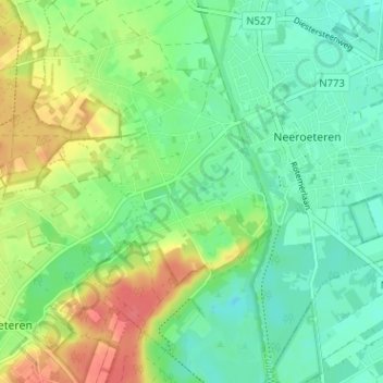
Name: Berg topographic map, elevation, terrain.
Location: Berg, Neeroeteren, Maaseik, Limburg, 3680, België (51.06285 5.66618 51.10285 5.70618)
Average elevation: 157 ft
Minimum elevation: 85 ft
Maximum elevation: 272 ft
Thank you for supporting this site ❤️
Make a donation
Make a donation
Gear up for your next adventure:
As an Amazon Associate, this site earns from qualifying purchases at no extra cost to you.