Geolocate

Hermosa topographic map

Click on the map to display elevation.

About this map

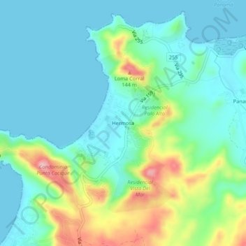
Name: Hermosa topographic map, elevation, terrain.

Location: Hermosa, Sardinal, Carrillo, Guanacaste, 50503, Costa Rica (10.55450 -85.69419 10.59450 -85.65419)

Average elevation: 148 ft

Minimum elevation: 0 ft

Maximum elevation: 584 ft

Gear up for your next adventure:

🏔️Mountain Trail Maps - High‑detail maps for popular peaks
🖼️Topo Map Wall Art - Decorative topographic prints of famous peaks and regions
🛰️Satellite Messengers - Emergency SOS and two-way messaging for off-grid adventures
🌄Hiking Binoculars - Compact binoculars for scenic views and trail spotting
🥩Freeze-Dried Meals - Nutritious and lightweight food for remote expeditions

As an Amazon Associate, this site earns from qualifying purchases at no extra cost to you.