
Thank you for supporting this site ❤️
Make a donation
Make a donation
Gear up for your next adventure:
As an Amazon Associate, this site earns from qualifying purchases at no extra cost to you.
Olmedillas topographic map
Click on the map to display elevation.
Thank you for supporting this site ❤️
Make a donation
Make a donation
Gear up for your next adventure:
As an Amazon Associate, this site earns from qualifying purchases at no extra cost to you.
About this map
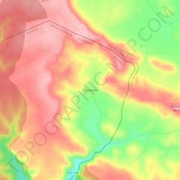
Name: Olmedillas topographic map, elevation, terrain.
Location: Olmedillas, Sigüenza, Guadalajara, Castilla-La Mancha, España (41.15319 -2.61053 41.19319 -2.57053)
Average elevation: 3,855 ft
Minimum elevation: 3,550 ft
Maximum elevation: 4,039 ft
Thank you for supporting this site ❤️
Make a donation
Make a donation
Gear up for your next adventure:
As an Amazon Associate, this site earns from qualifying purchases at no extra cost to you.
Other topographic maps
Click on a map to view its topography, its elevation and its terrain.