
Thank you for supporting this site ❤️
Make a donation
Make a donation
Gear up for your next adventure:
As an Amazon Associate, this site earns from qualifying purchases at no extra cost to you.
Montoi topographic map
Click on the map to display elevation.
Thank you for supporting this site ❤️
Make a donation
Make a donation
Gear up for your next adventure:
As an Amazon Associate, this site earns from qualifying purchases at no extra cost to you.
About this map
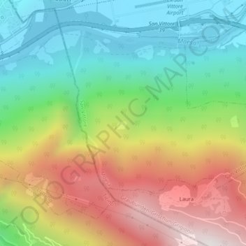
Name: Montoi topographic map, elevation, terrain.
Location: Montoi, San Vittore, Moësa, Grisons, 6534, Switzerland (46.21070 9.08046 46.23070 9.10046)
Average elevation: 2,618 ft
Minimum elevation: 820 ft
Maximum elevation: 5,276 ft
Thank you for supporting this site ❤️
Make a donation
Make a donation
Gear up for your next adventure:
As an Amazon Associate, this site earns from qualifying purchases at no extra cost to you.