
Thank you for supporting this site ❤️
Make a donation
Make a donation
Gear up for your next adventure:
As an Amazon Associate, this site earns from qualifying purchases at no extra cost to you.
Tzou topographic map
Click on the map to display elevation.
Thank you for supporting this site ❤️
Make a donation
Make a donation
Gear up for your next adventure:
As an Amazon Associate, this site earns from qualifying purchases at no extra cost to you.
About this map
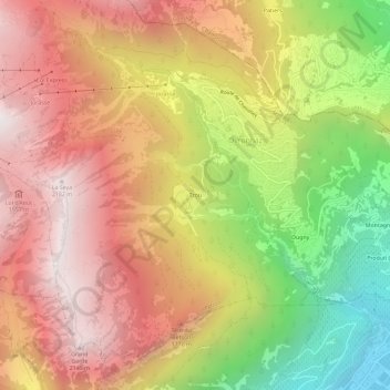
Name: Tzou topographic map, elevation, terrain.
Location: Tzou, Ovronnaz, Leytron, Martinach, Wallis, 1911, Schweiz (46.17332 7.14492 46.21332 7.18492)
Average elevation: 4,715 ft
Minimum elevation: 1,522 ft
Maximum elevation: 7,195 ft
Thank you for supporting this site ❤️
Make a donation
Make a donation
Gear up for your next adventure:
As an Amazon Associate, this site earns from qualifying purchases at no extra cost to you.