Geolocate

Barangay III topographic map

Click on the map to display elevation.

About this map
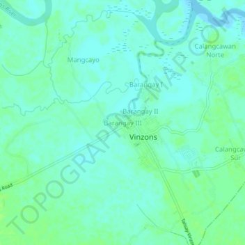
Name: Barangay III topographic map, elevation, terrain.

Location: Barangay III, Vinzons, Camarines Norte, Bicol Region, 4603, Philippines (14.15627 122.88415 14.19627 122.92415)

Average elevation: 13 ft

Minimum elevation: -3 ft

Maximum elevation: 30 ft

Other topographic maps

Click on a map to view its topography, its elevation and its terrain.
Mangcawayan

Philippines > Camarines Norte > Vinzons

Average elevation: 16 ft

Mangcawayan

Philippines > Camarines Norte > Vinzons

Average elevation: 16 ft

Gear up for your next adventure:

🚁Photography Drones - Capture stunning aerial views of landforms and topography
🪶Multi‑Purpose Knife - Useful blade for camp and trail
⛺Backpacking Tents - Weight-optimized shelters for multi-day topographic surveys
🪶Paracord Bracelet - Survival bracelet with built‑in tools
📱Solar Portable Charger - Solar power bank for charging devices off‑grid

As an Amazon Associate, this site earns from qualifying purchases at no extra cost to you.