
Thank you for supporting this site ❤️
Make a donation
Make a donation
Gear up for your next adventure:
As an Amazon Associate, this site earns from qualifying purchases at no extra cost to you.
Chatsworth topographic map
Click on the map to display elevation.
Thank you for supporting this site ❤️
Make a donation
Make a donation
Gear up for your next adventure:
As an Amazon Associate, this site earns from qualifying purchases at no extra cost to you.
About this map
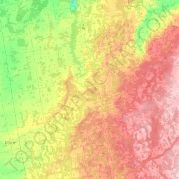
Name: Chatsworth topographic map, elevation, terrain.
Location: Chatsworth, Grey County, Ontario, Canada (44.28837 -81.10596 44.49624 -80.66178)
Average elevation: 1,040 ft
Minimum elevation: 600 ft
Maximum elevation: 1,486 ft
Thank you for supporting this site ❤️
Make a donation
Make a donation
Gear up for your next adventure:
As an Amazon Associate, this site earns from qualifying purchases at no extra cost to you.