Geolocate

Jhakri topographic map

Click on the map to display elevation.

About this map

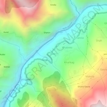
Name: Jhakri topographic map, elevation, terrain.

Location: Jhakri, Rampur, Shimla, Himachal Pradesh, 172201, India (31.46728 77.67576 31.50728 77.71576)

Average elevation: 4,990 ft

Minimum elevation: 3,212 ft

Maximum elevation: 8,018 ft

Other topographic maps

Click on a map to view its topography, its elevation and its terrain.

Daranghati WLS

India > Himachal Pradesh > Rampur > Kasha

Average elevation: 11,696 ft

Gear up for your next adventure:

🎒Trail Energy Bars - High‑calorie bars for hiking energy
GPS Sports Watch - GPS watch for running, hiking and training
🔥Plasma Lighters - Windproof lighters that work in any weather condition
🚪Portable Camp Chair - Foldable chair for comfort at camp
📶Vehicle Signal Boosters - Improve reception in rural areas while driving to trailheads

As an Amazon Associate, this site earns from qualifying purchases at no extra cost to you.