
Rice topographic map
Interactive map
Click on the map to display elevation.
About this map
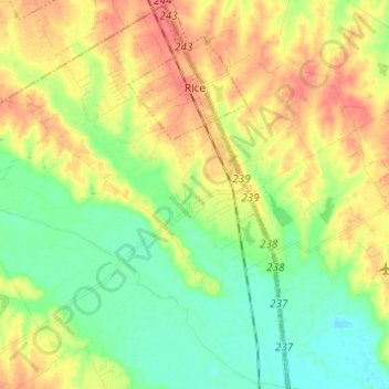
Name: Rice topographic map, elevation, terrain.
Location: Rice, Navarro County, Texas, United States (32.16385 -96.51943 32.26704 -96.46888)
Average elevation: 404 ft
Minimum elevation: 331 ft
Maximum elevation: 482 ft
Navarro County trails, hiking, mountain biking, running and outdoor activities
Other topographic maps
Click on a map to view its topography, its elevation and its terrain.