
Thank you for supporting this site ❤️
Make a donation
Make a donation
Gear up for your next adventure:
As an Amazon Associate, this site earns from qualifying purchases at no extra cost to you.
Jarhi topographic map
Click on the map to display elevation.
Thank you for supporting this site ❤️
Make a donation
Make a donation
Gear up for your next adventure:
As an Amazon Associate, this site earns from qualifying purchases at no extra cost to you.
About this map
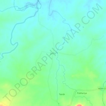
Name: Jarhi topographic map, elevation, terrain.
Location: Jarhi, Dandai, Garhwa District, Jharkhand, India (24.07820 83.64094 24.11820 83.68094)
Average elevation: 860 ft
Minimum elevation: 794 ft
Maximum elevation: 1,060 ft
Thank you for supporting this site ❤️
Make a donation
Make a donation
Gear up for your next adventure:
As an Amazon Associate, this site earns from qualifying purchases at no extra cost to you.