
Kesteren topographic map
Interactive map
Click on the map to display elevation.
About this map
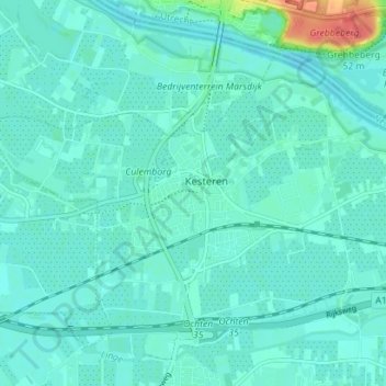
Name: Kesteren topographic map, elevation, terrain.
Location: Kesteren, Neder-Betuwe, Gelderland, Nederland (51.91807 5.53345 51.95083 5.60382)
Average elevation: 30 ft
Minimum elevation: 3 ft
Maximum elevation: 164 ft
Other topographic maps
Click on a map to view its topography, its elevation and its terrain.
Opheusden
Nederland > Gelderland > Neder-Betuwe
Opheusden, Neder-Betuwe, Gelderland, Nederland
Average elevation: 33 ft