Geolocate

Latag topographic map

Click on the map to display elevation.

About this map

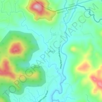
Name: Latag topographic map, elevation, terrain.

Location: Latag, Nasugbu, Batangas, Calabarzon, 4231, Philippines (14.10211 120.69898 14.14211 120.73898)

Average elevation: 433 ft

Minimum elevation: 115 ft

Maximum elevation: 1,240 ft

Other topographic maps

Click on a map to view its topography, its elevation and its terrain.

Talamitam

Philippines > Batangas > Nasugbu > Kayrilaw

Average elevation: 1,076 ft

Gear up for your next adventure:

🦶Hiking Gaiters - Keep debris and water out of your boots
🪄Magnetic Compass - Accurate compass for navigation
🏥Hiking First Aid Kits - Comprehensive medical kits for remote trail injuries
📱Solar Portable Charger - Solar power bank for charging devices off‑grid
🗃️Trail First Aid Kit - Essential kit for outdoor injuries and emergencies

As an Amazon Associate, this site earns from qualifying purchases at no extra cost to you.