
Thank you for supporting this site ❤️
Make a donation
Make a donation
Gear up for your next adventure:
As an Amazon Associate, this site earns from qualifying purchases at no extra cost to you.
Kilmington topographic map
Click on the map to display elevation.
Thank you for supporting this site ❤️
Make a donation
Make a donation
Gear up for your next adventure:
As an Amazon Associate, this site earns from qualifying purchases at no extra cost to you.
About this map
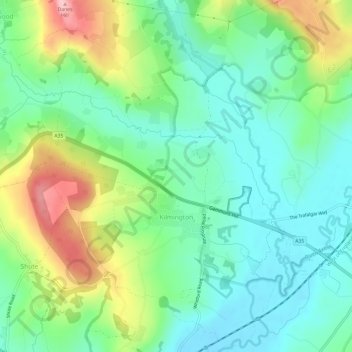
Name: Kilmington topographic map, elevation, terrain.
Location: Kilmington, East Devon, Devon, England, United Kingdom (50.76334 -3.05966 50.80124 -3.01718)
Average elevation: 223 ft
Minimum elevation: 36 ft
Maximum elevation: 614 ft
Thank you for supporting this site ❤️
Make a donation
Make a donation
Gear up for your next adventure:
As an Amazon Associate, this site earns from qualifying purchases at no extra cost to you.