Geolocate

Sloan topographic map

Click on the map to display elevation.

About this map

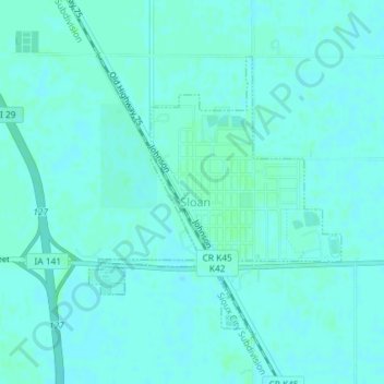
Name: Sloan topographic map, elevation, terrain.

Location: Sloan, Sloan Township, Woodbury County, Iowa, United States (42.22410 -96.23806 42.24323 -96.21408)

Average elevation: 1,070 ft

Minimum elevation: 1,063 ft

Maximum elevation: 1,079 ft

Woodbury County trails, hiking, mountain biking, running and outdoor activities

Other topographic maps

Click on a map to view its topography, its elevation and its terrain.

Stone State Park

United States > Iowa > Woodbury County > Sioux City

Average elevation: 1,230 ft

Stone State Park

United States > Iowa > Woodbury County > Sioux City

Average elevation: 1,230 ft

Leeds

United States > Iowa > Woodbury County > Sioux City

Average elevation: 1,188 ft

Gear up for your next adventure:

📷Action Cameras - Rugged cameras to document your journeys across rugged terrain
📦Dry Bags Set - Waterproof storage for electronics and clothes
🧦Hiking Socks - Comfortable socks to prevent blisters on long hikes
🎒Day Hiking Backpack - Lightweight backpack perfect for day trips and outdoor adventures
🪶Compact Camp Shovel - Folding shovel for campsite tasks

As an Amazon Associate, this site earns from qualifying purchases at no extra cost to you.