
Make a donation
Gear up for your next adventure:
As an Amazon Associate, this site earns from qualifying purchases at no extra cost to you.
Moscow Mountain topographic map
Click on the map to display elevation.
Make a donation
Gear up for your next adventure:
As an Amazon Associate, this site earns from qualifying purchases at no extra cost to you.
About this map
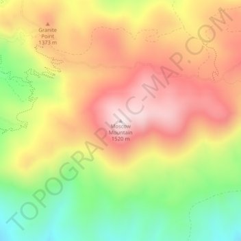
Name: Moscow Mountain topographic map, elevation, terrain.
Location: Moscow Mountain, Latah County, Idaho, United States (46.80345 -116.86882 46.80355 -116.86872)
Average elevation: 4,160 ft
Minimum elevation: 3,264 ft
Maximum elevation: 4,938 ft
Make a donation
Gear up for your next adventure:
As an Amazon Associate, this site earns from qualifying purchases at no extra cost to you.
Other topographic maps
Click on a map to view its topography, its elevation and its terrain.
Bovill
United States > Idaho > Latah County
Bovill is located at 46°51′33″N 116°23′40″W / 46.85917°N 116.39444°W / 46.85917; -116.39444 (46.859187, -116.394491), at an elevation of 2,874 feet (876 m) above sea level on the east bank of the Potlatch River.
Average elevation: 2,976 ft