Geolocate

Gotzing topographic map

Click on the map to display elevation.

About this map

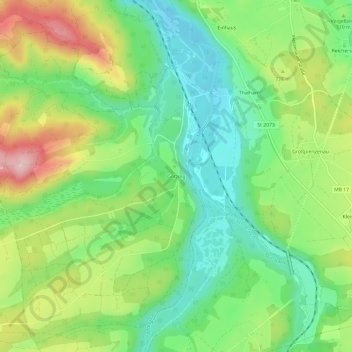
Name: Gotzing topographic map, elevation, terrain.

Location: Gotzing, Weyarn, Landkreis Miesbach, Bavaria, 83629, Germany (47.80700 11.78626 47.84700 11.82626)

Average elevation: 2,280 ft

Minimum elevation: 2,011 ft

Maximum elevation: 2,717 ft

Gear up for your next adventure:

🧢Sun Protection Hats - Wide-brimmed and UPF-rated hats for high-altitude sun safety
🦟Ultrasonic Repellers - Create a bug-free zone at your camp or rest stop
🧥Waterproof Jacket for Hiking - Breathable and rugged rain jacket for outdoor excursions
🍳Camping Cook Set - Complete cookware for outdoor meals
🏔️Mountain Trail Maps - High‑detail maps for popular peaks

As an Amazon Associate, this site earns from qualifying purchases at no extra cost to you.