
Make a donation
Gear up for your next adventure:
As an Amazon Associate, this site earns from qualifying purchases at no extra cost to you.
Isla Kent topographic map
Click on the map to display elevation.
Make a donation
Gear up for your next adventure:
As an Amazon Associate, this site earns from qualifying purchases at no extra cost to you.
About this map
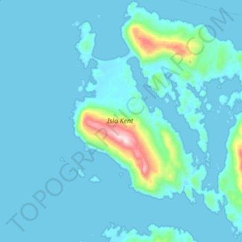
Name: Isla Kent topographic map, elevation, terrain.
Average elevation: 171 ft
Minimum elevation: -13 ft
Maximum elevation: 2,123 ft
Make a donation
Gear up for your next adventure:
As an Amazon Associate, this site earns from qualifying purchases at no extra cost to you.
Other topographic maps
Click on a map to view its topography, its elevation and its terrain.
Mirador Glaciar Exploradores
Chile > Región Aysén del General Carlos Ibáñez del Campo > Provincia de Aysén > Aysén
Average elevation: 778 ft
Pan de Azucar
Chile > Región Aysén del General Carlos Ibáñez del Campo > Provincia de Aysén > Aysén
Average elevation: 194 ft
Monte San Valentín
Chile > Región Aysén del General Carlos Ibáñez del Campo > Provincia de Aysén > Aysén
El monte San Valentín (también conocido como monte San Clemente) con una altitud de 4053 m s. n. m. es la montaña de mayor altura de la Patagonia occidental y la más alta al sur de los 40ºS fuera de la Antártida. Está en la cabecera de los Campos de Hielo Norte, entre el lago General Carrera y la laguna…
Average elevation: 11,056 ft
Los Torreones
Chile > Región Aysén del General Carlos Ibáñez del Campo > Provincia de Aysén > Aysén > Los Torreones
Average elevation: 886 ft
Make a donation
Gear up for your next adventure:
As an Amazon Associate, this site earns from qualifying purchases at no extra cost to you.
Isla Puentes
Chile > Región Aysén del General Carlos Ibáñez del Campo > Provincia de Aysén > Aysén
Average elevation: 46 ft