
Lusaka topographic map
Click on the map to display elevation.
Lusaka
Lusaka (/luːˈsɑːkə/; loo-SAH-kə) is the capital and largest city of Zambia. It is one of the fastest-developing cities in southern Africa. Lusaka is in the southern part of the central plateau at an elevation of about 1,279 metres (4,196 ft). As of 2019, the city's population was about 3.3 million, while the urban population is estimated at 2.5 million in 2018. Lusaka is the centre of both commerce and government in Zambia and connects to the country's four main highways heading north, south, east and west. English is the official language of the city administration, while Bemba, Tonga, Lenje, Soli, Lozi and Nyanja are the commonly spoken street languages.
About this map
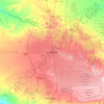
Name: Lusaka topographic map, elevation, terrain.
Location: Lusaka, Lusaka District, Lusaka Province, 10101, Zambia (-15.57634 28.12184 -15.25634 28.44184)
Average elevation: 4,026 ft
Minimum elevation: 3,491 ft
Maximum elevation: 4,426 ft
Other topographic maps
Click on a map to view its topography, its elevation and its terrain.